About Us
Leading the Future with Precision:
To leverage geospatial technology to create a smarter, more interconnected, and sustainable world where data-driven insights foster progress and elevate the quality of life for everyone
Empowering Decisions through Cutting-Edge Geospatial Solutions for a Smarter, Sustainable World.
Our Services
GIS Sevices
Geographic Information Systems (GIS) applications span various dimensions, encompassing a wide range of functionalities and use cases.
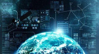
Remote Sensing
Remote sensing is the acquisition of information about an object or area from a distance, typically from aircraft or satellites.
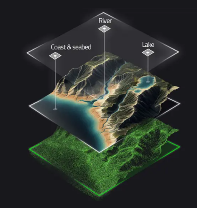
Mapping
Mapping is the process of creating visual representations of geographic areas to convey spatial information.
The only place where you’ll get the perfect solution for all your needs.
Our Applications
Industries We Can Serve!
GIS
Geographic Information Systems (GIS) are sophisticated platforms that enable the capture, storage, analysis, and visualization of spatial and geographic data. These systems are integral to a wide array of disciplines, offering transformative insights and solutions to intricate challenges. GIS applications are diverse, addressing critical needs across numerous fields.
- Mapping and Visualization
- Urban Planning and Management
- Environmental Conservation and Management
- Disaster Management and Risk Assessment
- Agriculture and Food Security
- Transportation and Logistics
- Natural Resource Exploration and Management
- Water Resource Management
- Climate Change Studies and Mitigation
- Energy and Utility Management
- Military and Defense Applications
- Telecommunications and Network Planning
- Tourism and Recreation Planning
- Retail and Business
Remote Sensing
Remote sensing is a cutting-edge technology that enables the collection and analysis of data about the Earth’s surface and atmosphere from afar, primarily using satellites and aircraft. This technology plays a crucial role across a wide range of disciplines, offering invaluable insights for environmental monitoring, urban planning, agriculture, disaster management, and climate change research. The following sections highlight some of the most impactful applications of remote sensing.
- Environmental Monitoring.
- Agriculture Monitoring crop health.
- Disaster Management
- Urban Planning:
- Climate Change Studies:
- Water Resource Management
- Forest monitoring and management
- Mining and Mineral Deposits Exploration
- Oceanography
- Biodiversity Conservation
- Soil Moisture Estimation
- Weather Forecasting
- Coastal Management
- Infrastructure Monitoring
- Pollution Detection
- Geological Mapping
- Urban Heat Island Analysis
- Archaeology
- Military Surveillance
- Public Health
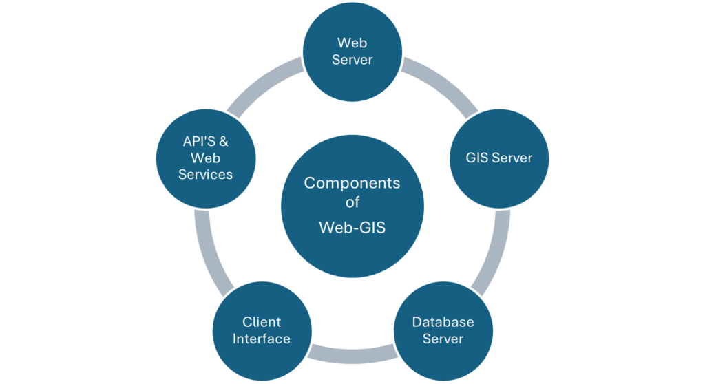
WEB GIS
Web GIS (Geographic Information System) refers to a GIS platform that can be accessed via the internet, enabling users to view, analyze, and interpret spatial data from any location with an internet connection. This technology has revolutionized the accessibility and usability of geopatial data, making GIS tools more broadly available and easier to use.
Applications of WEB GIS
- Visualization of zoning, infrastructure, and land use data for effective city planning.
- Tracking environmental changes like deforestation, pollution, and wildlife habitats.
- Real-time mapping and analysis for emergency response and resource allocation.
- Route planning, traffic management, and optimizing logistics operations.
- Engaging citizens in decision-making through access to spatial data and community maps.
- Mapping disease outbreaks, healthcare facility locations, and public health data.
- Assessing property values, viewing cadastral data, and managing land records
- Monitoring crop health, soil conditions, and managing farm resources.
- Mapping and managing infrastructure like water, electricity, and telecommunications networks.
- Creating interactive maps for tourist attractions, routes, and accommodation
- Analyzing consumer behavior, site selection, and market trends using spatial data.
Additional services
- LiDAR (Light Detection and Ranging) Survey
- Drones (Unmanned Aerial Vehicles – UAVs) Survey
- GPS Surveying
- 3D modelling
- Social and Demographic Survey
- Digitization
- Custom Applications